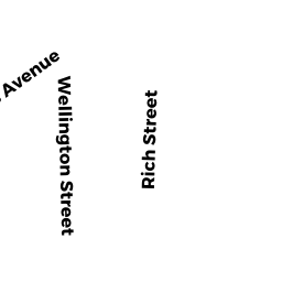
48 -50 RICH ST
Owner Information
ZHOU, PINGLEI & ZHE MENG
293 RIVER ST
WEST NEWTON, MA 02465


Property Details
48 -50 RICH ST is classified as a Two-Family Residential (Two family).
The primary structure on this property was built in 1920. There are 2,602ft2 of built area within this property. There is 2,602ft2 of residential/living space within this property. This property is listed as having 10 rooms. There are 2 units within this property.
48 -50 RICH ST is valued at $702,600. The land is valued at $284,500 and the structures are valued at $414,400. There is an additional valuation of $3,700 on this property.
The most recent deed for 48 -50 RICH ST is recorded at the local registrar in Book 69937, Page 378. 48 -50 RICH ST was last sold on Friday, September 15, 2017 for $675,000.
Assessment data from fiscal year 2022.
Flood Data
According to the FEMA National Flood Hazard Layer, this property does not appear to be in a flood zone. It may also be in an area not yet reviewed. Nonetheless, confirm this information prior to taking any action.
To view the flood hazards around this property, create a FEMA "Firmette" Map of the area around 48 -50 RICH ST.
Broadband Internet Providers
| Provider | Type | Bandwidth (mbps) | |
|---|---|---|---|
| GCI Communication Corp. | Satellite | 0 | 0 |
| RCN | Cable | 1000 | 20 |
| Viasat Inc | Satellite | 100 | 3 |
| Verizon New England Inc. | DSL | 15 | 1 |
| Verizon New England Inc. | Fiber | 940 | 880 |
| VSAT Systems, LLC. | Satellite | 2 | 1 |
| Crown Castle Fiber | Fiber | 0 | 0 |
| Comcast | Cable | 1000 | 35 |
| RCN | Cable | 500 | 20 |
| HughesNet | Satellite | 25 | 3 |
Broadband service provider data from December 2020.
Adjacent Properties
- 52 -01 RICH ST
Residential Condominium owned by DUVAL, CAROLE - 52 -02 RICH ST
Residential Condominium owned by GORDEN, JARED & CAROLYN - 49 WELLINGTON ST
Single Family Residential owned by ARIAS, JANNINA F INGA & DINA B - 43 -45 WELLINGTON ST
Three-Family Residential owned by PATEL, KAUSHIK D. & SMITA K. - 44 RICH ST
Two-Family Residential owned by J.L.S. REVOCABLE TRUST,